0429 621 565

Aerial Mapping,
Survy & FLIR

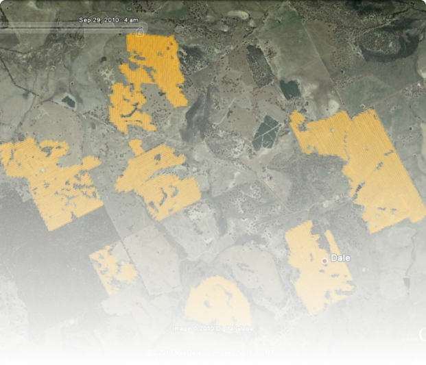
Our Helicopters are available for all types of fire mapping and survey. All areas can be mapped and recorded using our DGPS. This information can then be downloaded and reviewed on your computer system for overlaying onto other maps or Google earth if required. On request we can organise Flir,( Forward looking infrared imaging) which can record the perimeter, fire lines or look for hot spots that can not been found or seen by normal methods, The map or imagery can be sent direct from the helicopter to the fire control room via the Next G network for immediate analysis.

Book a Job

Protecting Our Community

First Fire Fighting Contract in 2008

Our firebombing fleet now consists of two Air Tractor 802's dedicated solely to fire, and one Air Tractor 602 that is utilised for both fire and agriculture. In 2000 our engineering team designed and built advanced fire-fighting retardant delivery systems to meet the scrupulous requirements of the RFS. We have been servicing the RFS above and beyond requirements since. As retardant delivery technology has improved Helispecs have remained pioneers in the industry and in partnership with Trotter Controls we are premiering the first two GEN 3 FRDS in 2019. These electric powered aluminium fire gates are significantly lighter. Advanced computers provide uniform delivery from the start of the drop to the finish

Your Local First Responders

The HELI family have called the Lachlan Valley home all their lives. Helispecs has a genuine and ongoing commitment to protecting our local area; through our advanced aircraft, fast response times, and longstanding cooperation with the RFS, resulting in deployment across the state.

Providing Contract Aircraft

HELISPECS is currently providing contract and call-when-needed fire suppression services in NSW. To learn more visit our fire suppression page.